MPIA Heidelberg: Unterschied zwischen den Versionen
Zur Navigation springen
Zur Suche springen
(Die Seite wurde neu angelegt: „File:Location: on top of the roof of the MPIA Heidelberg geogr. longitude: E 8°43'22" geogr. latitude: N 49°23'47" altitude: 560m a.s.l. <gallery> File:Luxmeter_mpia_1.jpg|Luxmeter on top of the roof of the MPIA Heidelberg. File:Luxmeter_mpia_2.jpg|Overview of northern direction. File:Luxmeter_mpia_3.jpg|Overview of eastern direction. </gallery> <gallery> File:DE_MPIA_20081012.jpg|12.10.2008 File:DE_MPIA_20081013.jpg|13.10.2008 File:D…“) |
(kein Unterschied)
|
Aktuelle Version vom 27. August 2023, 14:03 Uhr
File:Location:
on top of the roof of the MPIA Heidelberg
geogr. longitude: E 8°43'22"
geogr. latitude: N 49°23'47"
altitude: 560m a.s.l.
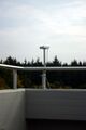
Luxmeter on top of the roof of the MPIA Heidelberg.

Overview of northern direction.
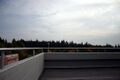
Overview of eastern direction.


12.10.2008

13.10.2008
14.10.2008
15.10.2008

16.10.2008

17.10.2008
18.10.2008
19.10.2008
20.10.2008

21.10.2008

22.10.2008
23.10.2008

24.10.2008
25.10.2008
26.10.2008

27.10.2008
30.10.2008
31.10.2008

01.11.2008
02.11.2008
03.11.2008


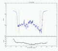
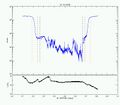
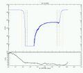
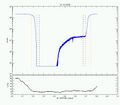
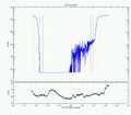
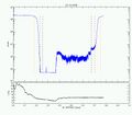
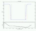
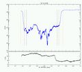
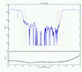
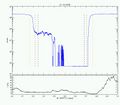
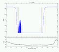
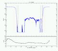
Orange dashed line is indicating rising and setting time of the sun. Red dashed line is indicating Nautical twilight. Black dashed line is indicating Astronomical twilight.